|
| *****SWAAG_ID***** | 267 |
| Date Entered | 06/08/2011 |
| Updated on | 25/11/2011 |
| Recorded by | Tim Laurie |
| Category | Tree Site Record |
| Record Type | Botanical HER |
| Site Access | Public Access Land |
| Record Date | 23/07/2011 |
| Location | East Stonesdale |
| Civil Parish | Muker |
| Brit. National Grid | NY 89723 02073 |
| Altitude | 390-380m |
| Geology | The Main Limestone.Vertical limestone cliff, facing due east with vegetated limestone scree/talus slope below. Immediately above East Stonesdale Beck, which
flows over low falls below the cliff, due south to join the Swale above Kisdon Falls. |
| Record Name | MUK133 East Stonesdale, Unnamed Limestone Ravine. Relict limestone ashwood with yews and junipers. |
| Record Description | West Bank, east facing limestone cliff(not named on the 1:25000 OS Map)
and ravine which commences some 300m upstream from Pry Hill Woods and Falls. The ravine extending upsteam for a further 200m.
Both ravine and east facing cliff support a rich mixed deciduous woodland community which includes a healthy population of the following tree and shrub species:
Ash,Downy Birch,Bird Cherry,Hazel,Hawthorn,Juniper,Downy Rose,Rowan,
Sallows,Stone bramble? (seen on small upper scar only), Wych Elm,Yew.
Tree species which do grow on limestone scars at similar elevations elsewhere in Swaledale not seen at the first visit include Aspen (Aspen is present at Swinnergill and above Birk Hill Scars,Blackthorn,Elder,Wild cherry or Gean,
Bramble (Rubus fruticosus agg),Ivy,
The presence of calcareous spring flushes on the eastern side of the ravine adds to the botanical significance of this site. A list of the plants recorded as present at this location will be made available shortly.
Raspberry. Holly has not been seen at this elevation in Swaledale.
NY8972302073 centre |
| Dimensions | N/A, see photographs. |
| Geographical area | Upper Swaledale |
| Additional Notes | the woodland on Long Scar in the upper reaches of East Stonesdale is one of the best examples of an isolated fragment of mixed deciduous woodland which may best be categorised after Rodwell, 1991 as W9 Limestone Upland Ashwood but with Juniper and Yew in addition. Juniper is listed with W11 Oakwood. Yew is listed in W8 Limestone Lowland Woodland but is not listed as present in W9 Upland Ashwood Community.(Rodwell,1991).
Reference
Rodwell, J.S. British Plant Communities Volume 1. Woodlands and Scrub.Cambridge. |
| Image 1 ID | 929 Click image to enlarge |
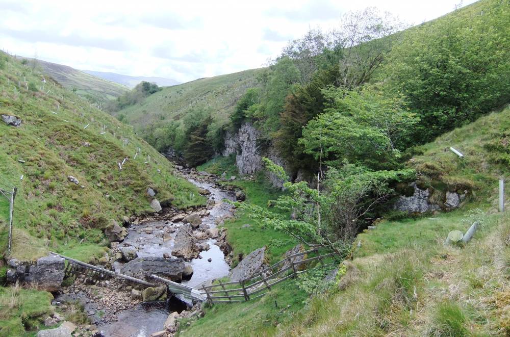
| Image 1 Description | East Stonedale. Long Scar from fence at upper limit of cliff. |  |
| Image 2 ID | 930 Click image to enlarge |
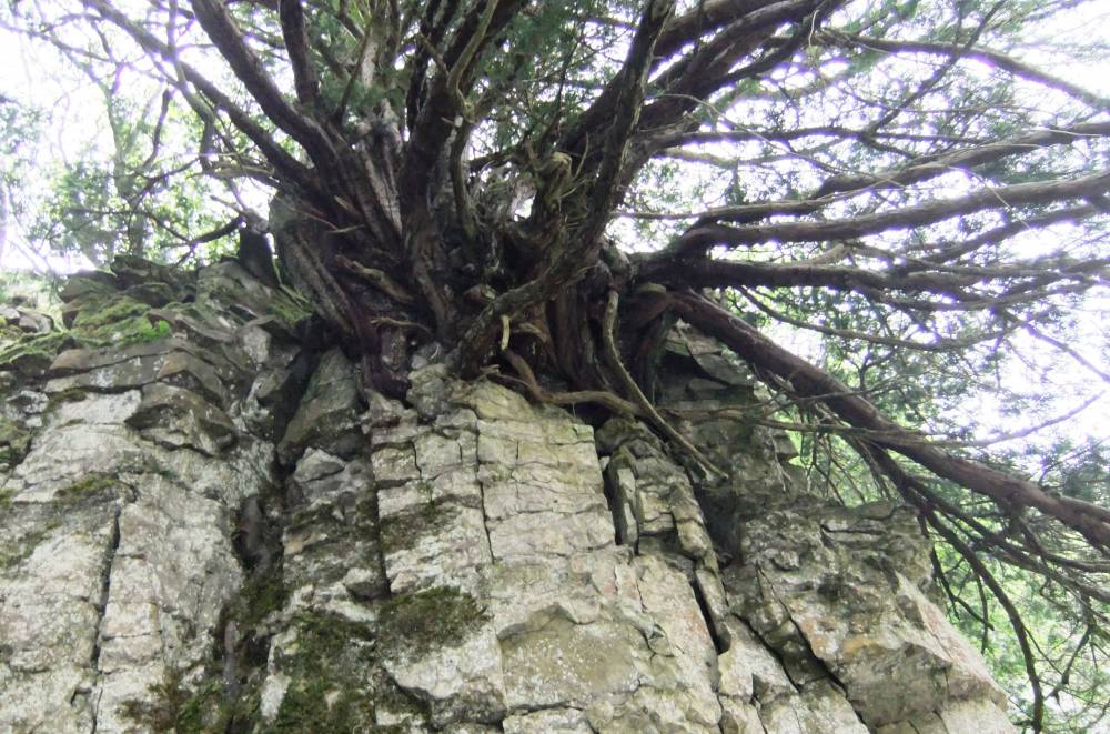
| Image 2 Description | East Stonedale. Long Scar. The Main Yew. | 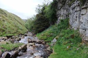 |
| Image 3 ID | 931 Click image to enlarge |
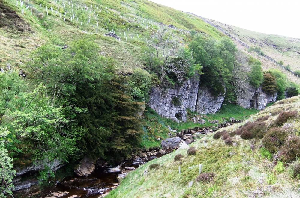
| Image 3 Description | East Stonedale. Long Scar. The cliff with yews, ash, hazel, wych elm, bird cherry and juniper. |  |
| Image 4 ID | 933 Click image to enlarge |
| Image 4 Description | East Stonedale. Long Scar. The Main Yew. Detail. |  |
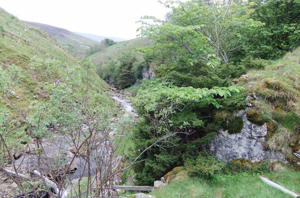
| Image 5 ID | 934 Click image to enlarge |
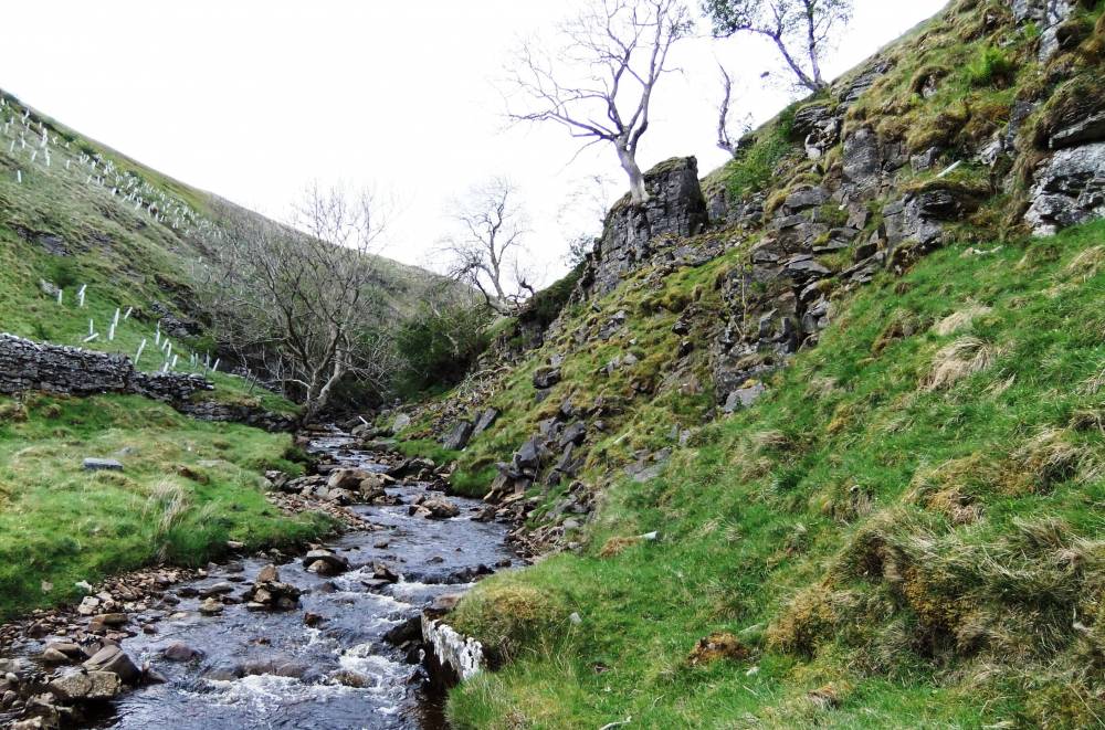
| Image 5 Description | East Stonedale. Long Scar. The lower end of the ravine. |  |
| Image 6 ID | 935 Click image to enlarge |
| Image 6 Description | East Stonedale. Long Scar Yew and Bird Cherry at top edge of the cliff. | 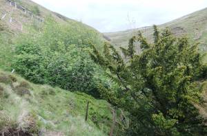 |
| Image 7 ID | 936 Click image to enlarge |
| Image 7 Description | East Stonedale. Long Scar. Juniper with bird cherry at top edge of the cliff. | 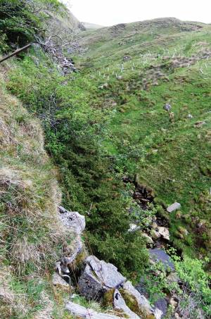 |
| Image 8 ID | 938 Click image to enlarge |
| Image 8 Description | Juniper and bird cherry at top edge of cliff. | 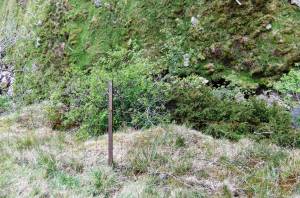 |
| Image 9 ID | 941 Click image to enlarge |
| Image 9 Description | Juniper with Wych Elm at upper end of the cliff, near waterfall. |  |
| Image 10 ID | 942 Click image to enlarge |
| Image 10 Description | Juniper with Wych Elm. Detail. | 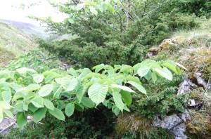 |